Having just concluded our first big international climbing expedition since COVID-19 hit earlier this year, I wanted to share some notes on my experience for climbers who are planning to climb with me in the future and climbers considering to join one of our upcoming programs.
Pacific Northwest
After the spring “lockdown” periods, we were finally able to get out into the mountains locally in Washington State beginning in late July when Mount Rainier National Park opened for commercial guiding. We operated our climb on Mount Rainier, as well as climbs on Mount Baker & Mount Shuksan in the North Cascades, all were successful, and everyone made it home safe and healthy. By allowing climbers to sleep in their own tent or for members of the same households to share tents, we maintained appropriate distancing measures and followed prescribed guidelines. Once we departed the trailheads, we could hike & climb without needing the masks, as we were appropriately spaced out. It was refreshing to be able to live “mask-free” for a while. This is a unique benefit of traveling to the mountains during the pandemic.
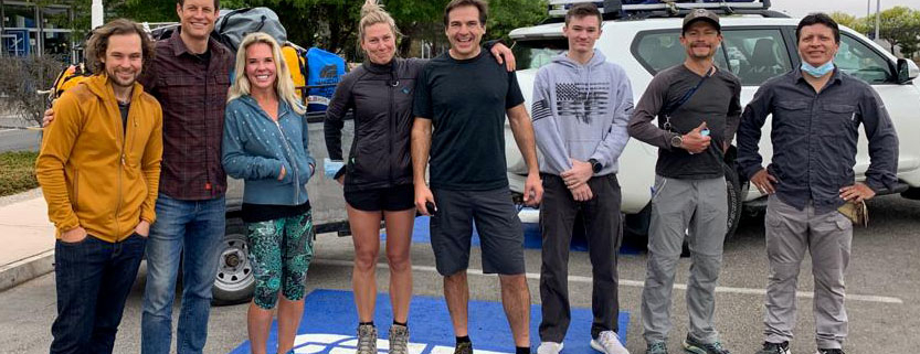
In August, we were able to operate our first Kilimanjaro program of the summer season. Myself and a father and daughter from Atlanta journeyed to Tanzania and climbed the tallest peak in Africa. We hardly saw anyone else on the mountain. It was surreal to experience Kilimanjaro nearly all to ourselves, as generally, the hiking trails and camps are fairly busy during the summer season. International travel was easy; we only needed to show a negative COVID test result within 72 hours of our travel to board the flight to Tanzania. Once we arrived in Tanzania, the logistics were seamless. The hotel staff in Arusha did a great job of making us feel safe. Our staff on the mountain was as welcoming as ever, all the while utilizing appropriate PPE to keep everyone safe. Reaching Kilimanjaro‘s summit with Drew and his daughter was a highlight for sure; we had it all to ourselves as we watched the sunrise.
After the climb, I flew back to the USA, while Drew and Jordan continued on for the safari. From their photos and reports, the game viewing was the best I’ve ever heard of. They didn’t see many other vehicles on safari, similar to their experience on the mountain, which is why I imagine the animals were in abundance and often ventured close to their vehicle. Overall, it was an incredible trip for them. We also felt very welcomed by the people of Tanzania. The pandemic has crushed their tourism industry, and they were very excited and happy to have us visit. We’ve operated more Kilimanjaro programs since, and they’ve gone perfectly. I look forward to returning in late January for my next Kili climb! If you’re interested in joining, please contact us!
The next international expedition I planned was to Nepal, a country I regularly visit for mountaineering in the spring and fall seasons. Unfortunately, we could not visit Nepal this past spring as Nepal went into lockdown, suspending all international flights from mid-March onwards. We patiently awaited Nepal to reopen so that we could plan a climb. Fortunately, the country announced it would open on October 17th for international travelers. Only travelers who are part of a mountaineering or trekking program could enter the country in the gradual reopening process.
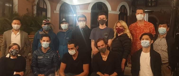
The process for us to obtain “visa-on-arrival” approval letters from the Nepal Ministry of Immigration involved us having to process our mountaineering permit ahead of time. With the help of our Nepalese partner agency, we were able to procure the permits and visa-on-arrival letters for our whole team in advance so that when we arrived, the immigration process was smooth and seamless. We were the only foreigners at the immigration counter, a new experience for me! We also had to bring our negative COVID PCR test result and show proof of COVID travel insurance, which is not expensive but was initially hard to find. Our expedition team was the first to enter Nepal since the lockdown back in March, so the process was new for everyone.
Once we entered Nepal, we were required to quarantine at our hotel for about a week. During this time, we had to take another COVID PCR test. This was easy as we arranged for the test to be done at the hotel. The six days of quarantine within the guidelines at Kathmandu’s Hotel Yak & Yeti were pleasant; we did morning yoga on the lawn, played tennis, exercised in the fitness center, did some sightseeing around town, and went out to dinner at the various restaurants open in Kathmandu. The staff at the hotel were very friendly and ensured we had a comfortable and safe visit.
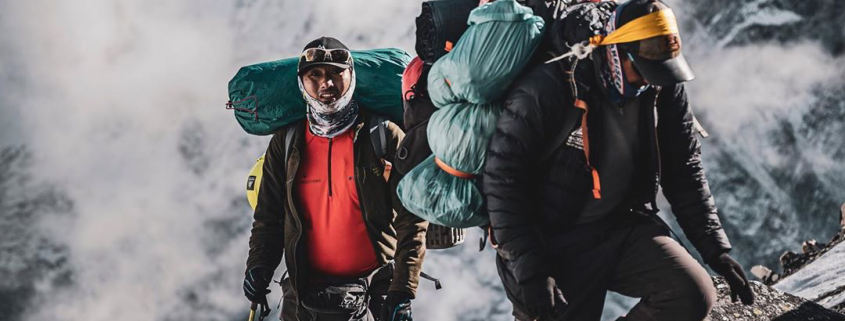
We flew to Lukla and began our trek to base camp. We didn’t see any other foreign trekkers on the trail, just a few locals. The villages in the Khumbu valley were very quiet, and only a few lodges were open. It was wonderful to reconnect with the families of the Khumbu and stay in their lodges. They were very welcoming and friendly. Since we had just recently tested negative for COVID in Kathmandu, we were not worried about spreading the virus but took responsible precautions to stay safe.
For the most part, the people in the Khumbu did not seem very concerned about the virus. However, we practiced responsible travel by masking-up initially if we went into a home or business. Since the Nepalese lost out on the entire spring climbing/trekking season, they were happy to see us return this autumn. Fall is usually the busiest trekking season in Nepal, and our group was the first commercial foreign team to venture into the Khumbu valley. There would be just a few small teams behind us in the coming weeks, a tiny fraction of the norm.
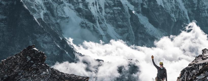
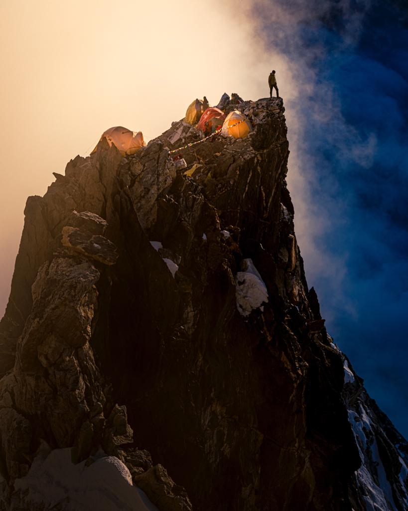
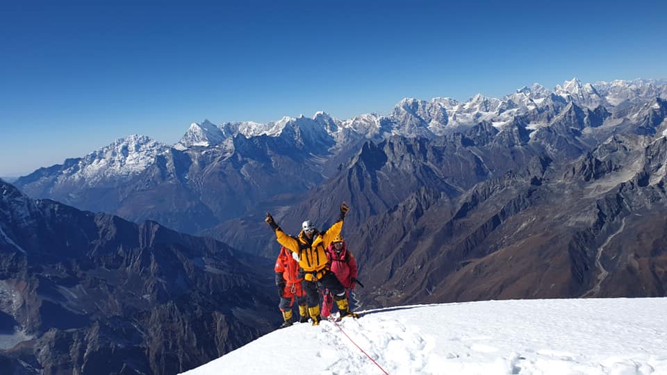
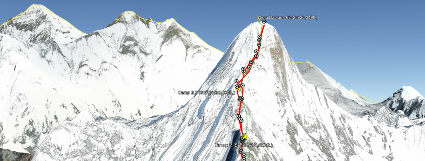
Arriving in Ama Dablam base camp was an occasion to celebrate! Ama Dablam base camp is one of the most beautiful and pleasant base camps I’ve ever visited over the years. Once we were in our base camp, we could practically forget all about COVID. Our team (foreign & Nepali) had tested negative for COVID just days before, so we were assured that our base camp community was virus-free. However, our staff continued to practice safe and responsible sanitation and cleanliness measures. It was refreshing to be able to relax, enjoy the spectacular views base camp affords, the comfort of our personal tents, and the quality of the meals. With Wi-Fi and a hot shower, it felt like “glamping!” Initially, we were the only team in base camp. Later on, another team showed up and would climb after us.
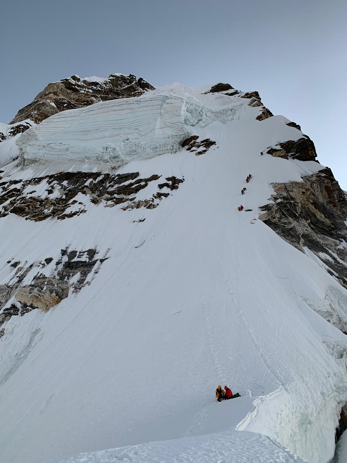
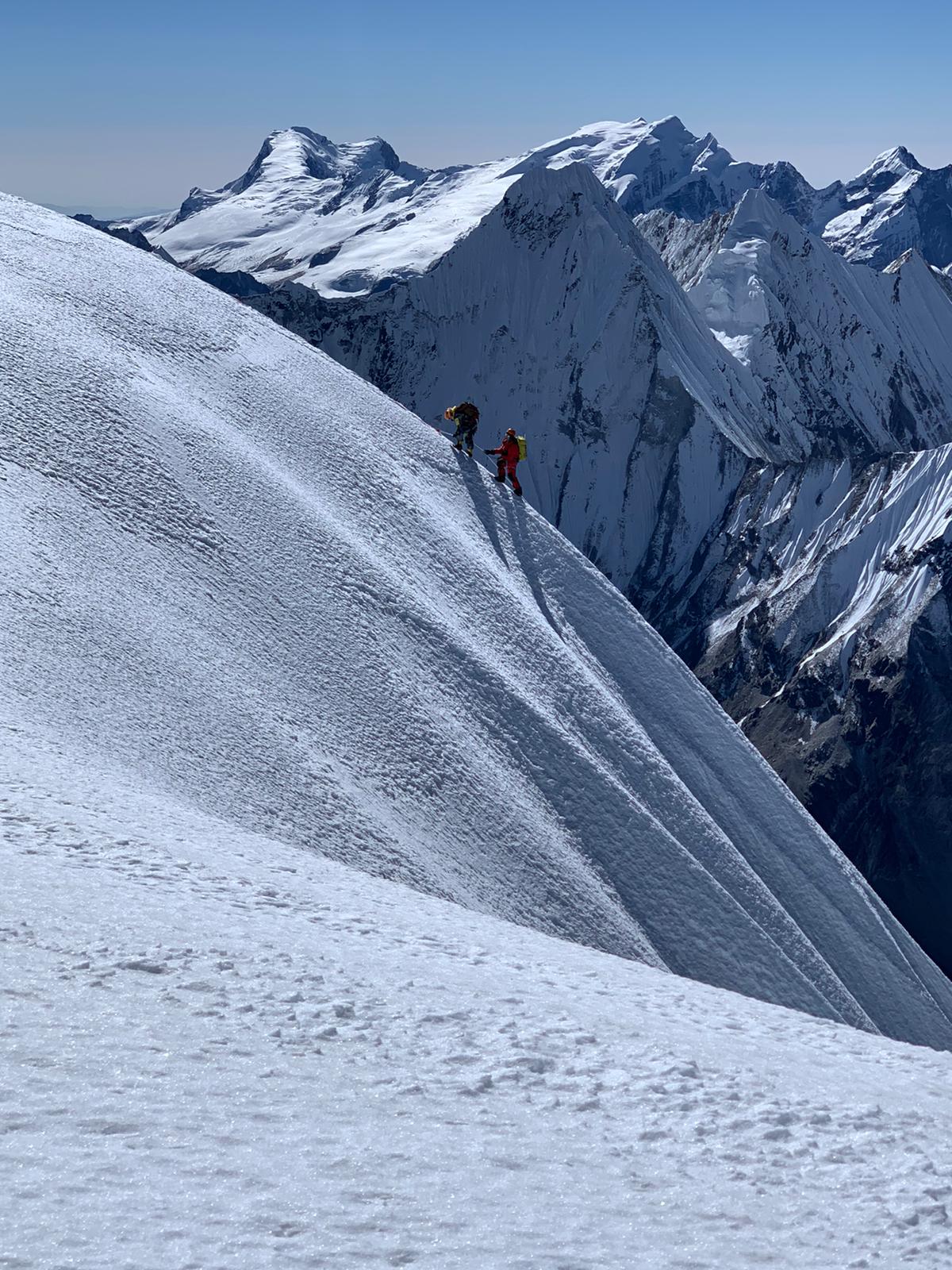
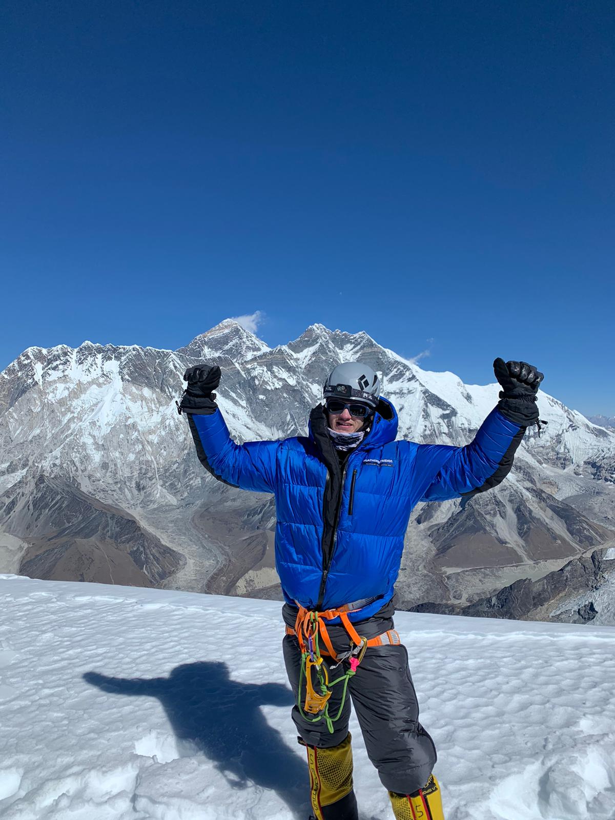
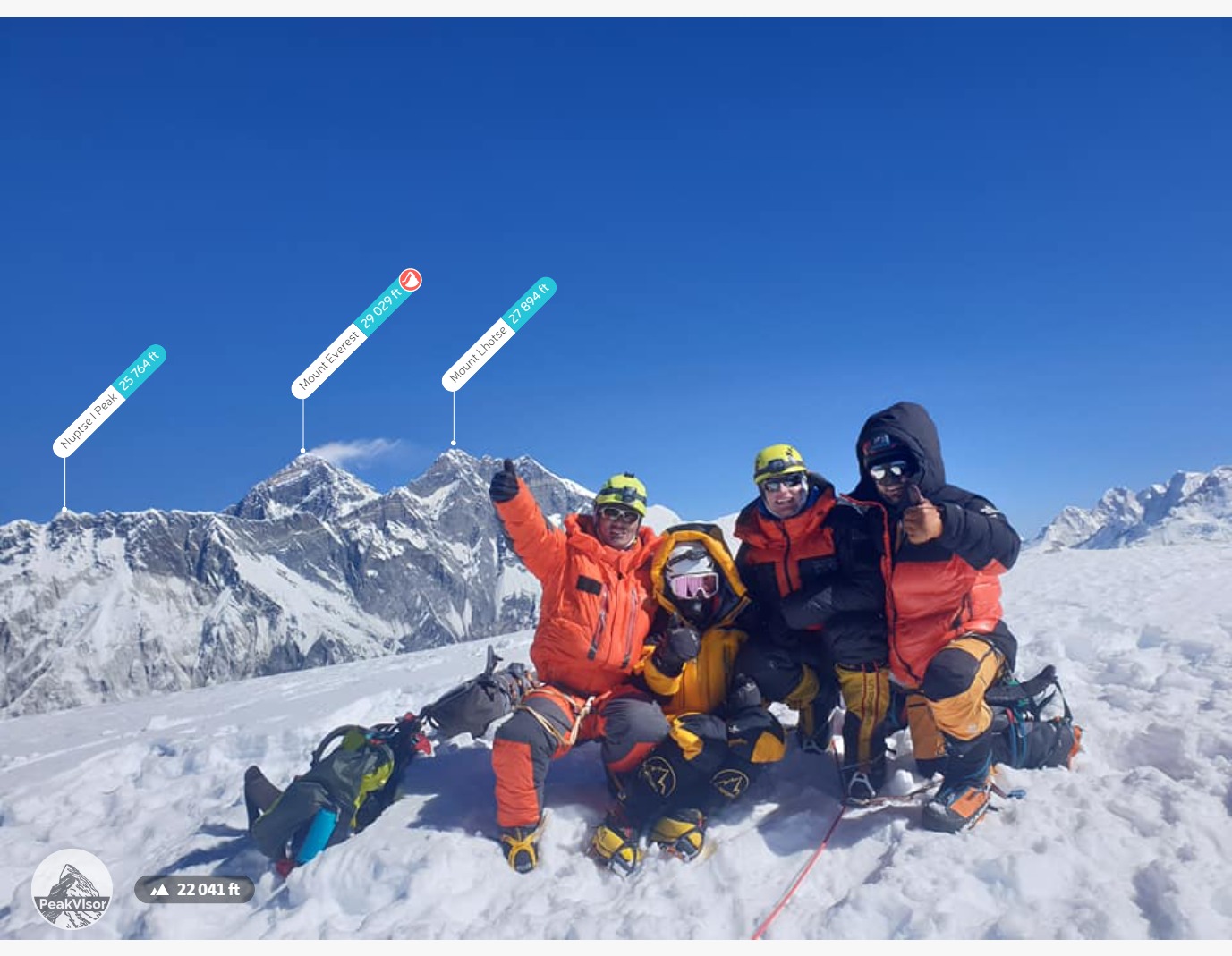
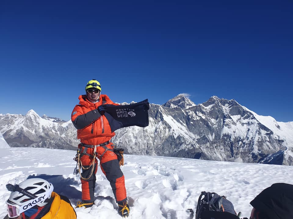
Climbing the mountain was a bit more complex than a “normal” season on Ama Dablam. Since we were the first team on the mountain, we had to fix the lines ourselves. This is nothing new to our crew, as we were also the first team to climb Ama Dablam last year and fixed the lines on Everest during the last 2 spring seasons (2018 & 2019). Our highly skilled Sherpa team helped out with this task as well as establishing the higher camps. We climbed up to Camp 2 to acclimatize, then rested a few days in base camp before setting out for the summit push. The weather this autumn in Nepal has been very dry, so the route conditions were nice. We had a beautiful summit day, with everyone making it to the top and back down safely. Afterward, we decided to helicopter out from base camp back to Kathmandu, then depart for our home countries. Everyone made it home safely and COVID-free. I can’t imagine how it could have gone better; we were very fortunate. I look forward to returning to Nepal in the spring for Everest. I suspect that the mountain will be less busy than usual, a welcome scenario, as I imagine many people will still be afraid to travel internationally.
What’s Next
We are currently planning more climbs in Ecuador and Chile. Our Total Eclipse Climb program in Chile, as well as Ojos del Salado (2nd highest peak in South America and the highest active volcano in the world), is set to begin December 8th, the day after Chile suspends the mandatory 14-day quarantine for arriving passengers. We are also operating several Ecuador programs planned in the coming months.
Many people have asked how it’s possible for us to travel internationally during this time, assuming that the whole world is still in lockdown. While some countries are still in lockdown and travel there is not possible. Many countries are open and accessible by following the prescribed guidelines. Nearly every major mountaineering guide service has suspended international operations through 2020. However, as a boutique company, we can continue operating to some degree, at least in countries that are open, by complying with the local regulations. We’ve become familiar with the new requirements and procedures for traveling internationally, such as where and how to get the COVID PCR test, how to procure COVID travel insurance, which airlines are operating, etc.
By continuing to operate responsibly, we can facilitate meaningful experiences for our guests while providing much-needed tourist revenue for the local communities that depend on mountain travelers for survival. These communities have been hit very hard by the response to the pandemic. Traveling during this time can mean less crowded peaks and makes an important contribution to the local communities that need our help. Traveling now can also inspire others. We’ve all been affected in some way by the pandemic. It’s refreshing to know that we can still pursue our goals and aspirations that involve international travel.